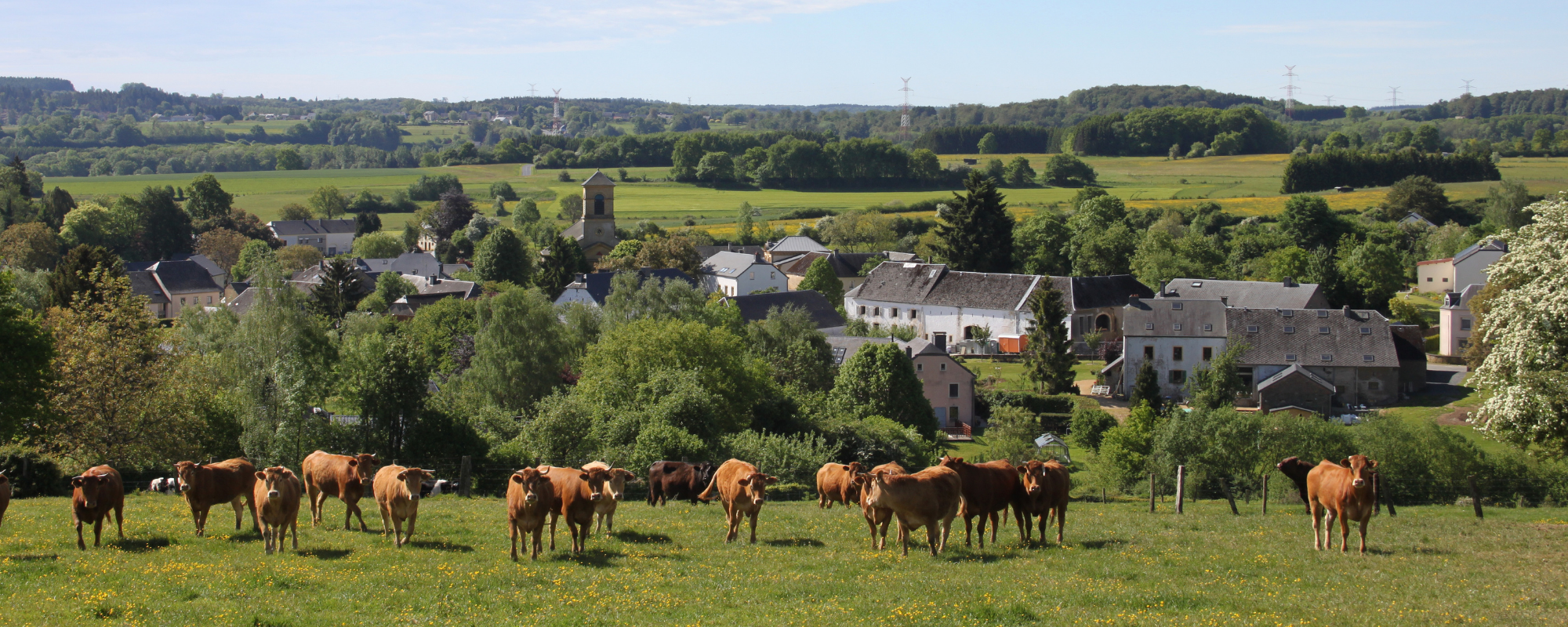
On the edge of the Ardennes, Nobressart stretches out in a hemicycle of soft green.
Indicating the Ardennes massif, the dark, wooded crown of the vast Anlier forest covers the village to the north. To the south and east, meadows and crops announce the gently undulating landscapes of Lorraine.
In the village, the farms, most of which are attached to each other, are adorned with a typically Lorraine-coloured plaster, giving the whole a very soft impression. This short and pleasant walk will lead you through a rural landscape to the Notre-Dame chapel and its vast panorama over the first Lorraine cuesta!
Tourist sites
Former wash house
Former quarry: Site of Great Biological Interest “Natura 2000
Burgknapp: circular enclosure with a defensive role perched on a rocky spur
Former tramway: Arlon-Martelange
Native deciduous forests: Site of Great Biological Interest “Natura 2000
Notre-Dame chapel and remarkable tree: Small-leaved lime tree
Panorama: Landscape and first Lorraine “coast”, called the Sinémurian cuesta
Wet meadows: Site of Great Biological Interest “Natura 2000
Practical information
Ce circuit vous est proposé en partenariat avec le Syndicat d’Initiative du Val d’Attert.
Syndicat d’initiative du Val d’Attert
Voie de la Liberté, 107
6717 Attert
Tél. : +32(0)63 23 62 88 Site web
The association Les Plus Beaux Villages de Wallonie (The Most Beautiful Villages of Wallonia) oversees a network of 32 villages, bearers of a strong territorial identity and reflecting traditional architecture. It is committed to promoting the rural, cultural and natural heritage of Wallonia and is a part of the development of local and responsible tourism.
Subscribe to the newsletter of the Most Beautiful Villages in Wallonia
Nous utilisons des cookies pour assurer le bon fonctionnement de notre site web, réaliser des analyses de trafic et proposer des publicités adaptées à vos intérêts. Modifiez vos préférences à tout moment sur notre page de Politique de Confidentialité.
Modifiez vos préférences à tout moment sur la page de notre Politique de Confidentialité.